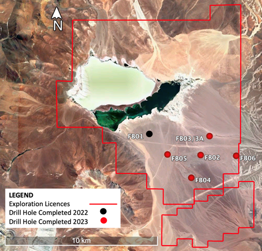
Viento Andino has a total exploration licence area of 127km2 and is located within 100km of the Laguna Verde project with similar distances to key infrastructure.
The project area is traversed by existing power lines and a water supply pipeline, while a substation connected to the Chile national grid is located at the Maricunga Gold mine which is only 5km from Viento Andino. The project lies at an altitude of 4,150m and is accessed via the international highway 31 and then a well-maintained 45km mining haul road.
A pump test programme completed at the project recorded a high transmissivity that corresponds to a modelled flow rate of approximately 80L/s in an operation stage well design.
A scoping study was also published in September 2023 where results highlighted the robust economics for a 20,000tpa over a 12-year period with low operating costs and payback period of 2 years and 7 months.

Following an exploration drilling programme completed in 1H 2023, the JORC resource estimate at Viento Andino has been upgraded from 0.55 mt to 0.92 mt of LCE including an Indicated resource of 0.44 million tonnes LCE.
The next work programme would involve drilling three diamond drill holes in the resource area, including one drill hole in the FB02 location. The objectives of these drill holes are to improve the resource calculation and obtain porosity samples for aquifer specific yield estimation.
Average grade of resource estimate
